Geography
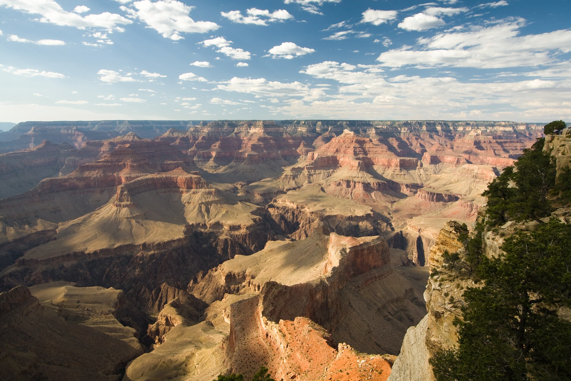
[ edit ] Image of the Grand Canyon and surrounding area taken from the International Space Station The Grand Canyon from an airplane, with the Colorado River visible Grand Canyon, Arizona, Nevada, Lake Powell to Lake Mead , June 27, 2017, Sentinel-2 true-color satellite image. Scale 1:450,000. The Grand Canyon is a river valley in the Colorado Plateau that exposes uplifted Proterozoic and Paleozoic strata , and it is also one of the six distinct physiographic sections of the Colorado Plateau province. Even though it is not the deepest canyon on land in the world ( Kali Gandaki Gorge in Nepal is much deeper ), the Grand Canyon is known for its visually overwhelming size and its intricate and colorful landscape. Geologically, it is significant because of the thick sequence of ancient rocks that are well preserved and exposed in the walls of the canyon. These rock layers record much of the early geologic history of the North American continent. Uplift associated with mountain formation later moved these sediments thousands of feet upward and created the Colorado Plateau. The higher elevation has also resulted in greater precipitation in the Colorado River drainage area, but not enough to change the Grand Canyon area from being semi-arid. The uplift of the Colorado Plateau is uneven, and the Kaibab Plateau that the Grand Canyon bisects is over one thousand feet (300 m) higher at the North Rim than at the South Rim. Almost all runoff from the North Rim (which also gets more rain and snow) flows toward the Grand Canyon, while much of the runoff on the plateau behind the South Rim flows away from the canyon (following the general tilt). The result is deeper and longer tributary washes and canyons on the north side and shorter and steeper side canyons on the south side. : 406 Temperatures on the North Rim are generally lower than those on the South Rim because of the greater elevation (averaging 8,000 feet or 2,400 meters above sea level). Heavy rains are common on both rims during the summer months. Access to the North Rim via the primary route leading to the canyon ( State Route 67 ) is limited during the winter season due to road closures.
Geology
[ edit ] Main article: Geology of the Grand Canyon area Diagram showing the placement, age and thickness of the rock units exposed in the Grand Canyon Rockfalls in recent times, along with other mass wasting , have further widened the canyon The Grand Canyon is part of the Colorado River basin, which has developed over the past 70 million years. For more than 150 years, scientists have gathered data, proposed new ideas, and debated sometimes contentious theories about the geologic origins of the Grand Canyon and the Colorado River. Formation of the Grand Canyon and the Colorado River may involve a complex history in which multiple factors and geologic processes have interacted over time and in different locations. In the most recent round of "old river" vs. "young river" controversy, researchers have challenged estimates that had placed the age of the canyon at 5–6 million years. The research has aroused considerable controversy because it suggests a substantial departure from prior widely supported scientific consensus. In a 2008 study, Victor Polyak examined caves near the Grand Canyon and placed their origins about 17 million years ago. The study, which was published in the journal Science in 2008, used uranium-lead dating to analyze calcite deposits found on the walls of nine caves throughout the canyon. In another 2008 study, Rebecca Flowers reported on apatite (U-Th)/He thermochronometry results suggesting that parts of the Grand Canyon had reached a depth near to the modern depth around 20 million years ago. In a subsequent study published in the journal Science in 2012, she suggested that the western part of the Grand Canyon could be as old as 70 million years. The emerging scientific consensus is that the canyon is made up of multiple segments which formed at different times and eventually connected to become the waterway now traversed by the Colorado River. Of the three central segments, the "Hurricane" was formed 50–70 million years ago, and the "Eastern Grand Canyon" was cut 15–25 million years ago. In contrast, the "Marble Canyon" and "Westernmost Grand Canyon" segments at the ends of the canyon were carved in the last five to six million years. The
Hydrology
[ edit ] Ribbon Falls, near the North Kaibab Trail , is produced by ground water reaching the surface Groundwater flow in the Grand Canyon region is an active area of study. Groundwater forms when rain soaks down into the earth and reaches the water table . The composition of the earth in a given area determines its permeability , the ease with which water flows through it. Sand is more permeable than clay. Less permeable rock layers composed of clay can block the passage of water and are known as aquitards . More permeable areas of rock that hold and transport groundwater underground are known as aquifers . An area of water bounded by two aquitards is called a confined aquifer, while water below the surface and above an aquitard is called an unconfined aquifer. The different geologic levels of the Grand Canyon have created two major aquifers where groundwater collects. The higher C-aquifer is an unconfined aquifer. It collects groundwater that seeps through the Kaibab and Toroweap Formations into the Coconino Sandstone. Below it, the Permian Hermit Formation and Supai Group provide a dense barrier. Groundwater from the C-aquifer can flow laterally, appearing as seeps along the canyon walls at the base of the Coconino Sandstone but can also descend vertically through fault zones to recharge the underlying confined R-aquifer. The R-aquifer, also known as the Red Wall Muav aquifer, is a karst aquifer. It involves an area of substantial fracturing through the Redwall Limestone, Temple Butte Formation and Cambrian Muav Limestone of the Tonto Group. Five individual systems flow through the R-aquifer and compose the regional groundwater-flow system which drains into the Grand Canyon: Kaibab, Uinkaret-Kanab, Marble-Shinumo, Cataract, and Blue Spring. The flow of groundwater in the Grand Canyon region is influenced in multiple ways by geologic faults and folds . Discharge from the R-aquifer appears as springs and seeps in both the Grand Canyon and tributary canyons. Springs discharge to the Grand Canyon in areas of lower Paleozoic carbonates, and are associated with geologic faults and fractures. Fractures are believed to provide dominant pathways both for vertical circ
Native Americans
[ edit ] The Ancestral Puebloans were a Native American culture centered on the present-day Four Corners area of the United States. They were the first people known to live in the Grand Canyon area. The cultural group has often been referred to in archaeology as the Anasazi, although the term is not preferred by the modern Puebloan peoples . The word "Anasazi" is Navajo for "enemy ancestors" or "alien ancestors". Archaeologists still debate when this distinct culture emerged. The current consensus, based on terminology defined by the Pecos Classification , suggests their emergence was around 1200 BCE during the Basketmaker II Era . Beginning with the earliest explorations and excavations, researchers have believed that the Ancestral Puebloans are ancestors of the modern Pueblo peoples . In addition to the Ancestral Puebloans, a number of distinct cultures have inhabited the Grand Canyon area. The Cohonina lived to the west of the Grand Canyon, between 500 and 1200 CE . The Cohonina were ancestors of the Yuman , Havasupai , and Hualapai peoples who inhabit the area today. The Sinagua were a cultural group occupying an area to the southeast of the Grand Canyon, between the Little Colorado River and the Salt River , between approximately 500 and 1425 CE . The Sinagua may have been ancestors of several Hopi clans. By the time of the arrival of Europeans in the 16th century, newer cultures had evolved. The Hualapai inhabit a 100-mile (160 km) stretch along the pine-clad southern side of the Grand Canyon. The Havasupai have been living in the area near Cataract Canyon since the beginning of the 13th century, occupying an area the size of Delaware . The Southern Paiutes live in what is now southern Utah and northern Arizona. The Navajo , or Diné, live in a wide area stretching from the San Francisco Peaks eastwards towards the Four Corners. Archaeological and linguistic evidence suggests the Navajo descended from the Athabaskan people near Great Slave Lake , Canada, who migrated after the 11th century. In the mythology of some Third Mesa Hopi communities, the Grand Canyon was the location humankind arose out of the Third World from a sipapu .