SAGE MUSEUM
← SIGIRIYA
Sigiriya
WONDERS · MONUMENTS · SACRED PLACES

Sigiriya

DEEPER DIVE
Central Province, Sri Lanka
Explore Smithsonian records, photographs, research, archives and collection material tied directly to this place.
WIKIPEDIA · RESEARCH
WIKIDATA · STRUCTURED DATA
WIKIMEDIA COMMONS · IMAGES
UNESCO · HERITAGE
SIGIRIYA · OVERVIEW
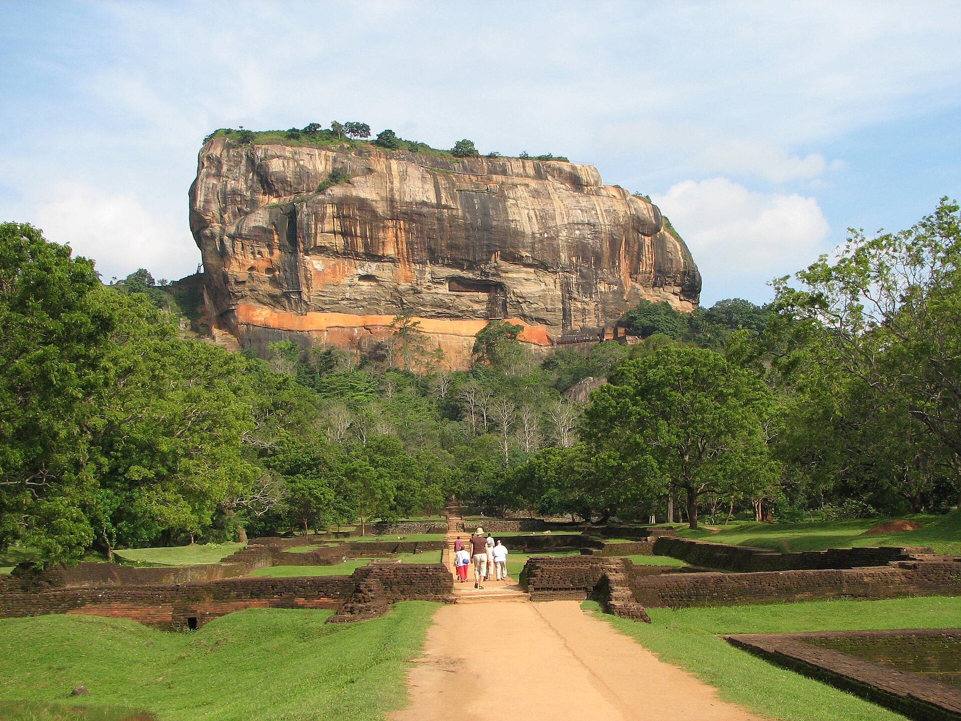
Sigiriya or Sinhagiri is an ancient rock fortress located in the northern Matale District near the town of Dambulla in the Central Province, Sri Lanka. It is a site of historical and archaeological significance that is dominated by a massive column of granite approximately 180 m (590 ft) high.
LOCATION · 7.95694, 80.75972
DEEPER RESEARCH
History
[ edit ] It is likely that the area around Sigiriya was inhabited since prehistoric times. There is clear evidence from Brahmi inscriptions on the western side of Sigiriya that the many rock shelters and caves in the vicinity were occupied by Buddhist monks and ascetics from as early as the 1st or 2nd century BCE. The earliest evidence of human habitation at Sigiriya is the Aligala rock shelter to the east of Sigiriya rock, indicating that the area was occupied circa 3000 BCE during the Mesolithic Period . Aerial view of Sigiriya Rock Map of Sigirya archaeological site. Buddhist monastic settlements were established during the 3rd century BCE in the western and northern slopes of the boulder-strewn hills surrounding the Sigiriya rock. Several rock shelters or caves were created during this period. These shelters were made under large boulders, with carved drip ledges around the cave mouths. Rock inscriptions are carved near the drip ledges on many of the shelters, recording the donation of the shelters to the Buddhist monastic order as residences. These were made in the period between the 3rd century BCE and the 1st century CE. [ citation needed ] The Cūḷavaṃsa describes that in 477 CE, Kashyapa I , the son of King Dhatusena by a non-royal consort, seized the throne in a coup assisted by Migara, the King's nephew and army commander. He murdered his father by walling him up alive and then usurped the throne which rightfully belonged to his half-brother Moggallana who, fearing for his life, fled to South India , but vowed revenge. Expecting the inevitable return of Moggallana, Kashyapa moved the capital and his residence from the traditional capital of Anuradhapura to the more secure summit of Sigiriya. During King Kashyapa's reign (477–495 CE), Sigiriya was developed into a complex city and fortress. Most of the elaborate constructions on the rock summit and around it, including defensive structures, palaces, and gardens, date from this period. [ citation needed ] When Moggallana finally arrived, he declared war, and defeated Kashyapa in 495 CE. During the battle Kashyapa's armies abandoned him and he committed suicide by falling on his sword. The Cūḷavaṃsa and f
Archaeological remains and features
[ edit ] The Lion Gate and Climbing Stretch In 1831 Major Jonathan Forbes of the 78th (Highlanders) Regiment of Foot of the British Army, while returning on horseback from a trip to Pollonnuruwa, encountered the "brushwood-covered summit of the rock of Sigiri". Sigiriya came to the attention of antiquarians and, later, archaeologists. Archaeological work at Sigiriya began on a small scale in the 1890s. H.C.P. Bell was the first archaeologist to conduct extensive research on Sigiriya. The Cultural Triangle Project, launched by the Government of Sri Lanka , focused its attention on Sigiriya in 1982. Archaeological work began on the entire city for the first time under this project. There was a sculpted lion's head above the legs and paws flanking the entrance, but the head collapsed years ago. [ when? ] Sigiriya consists of an ancient citadel built by King Kashyapa during the 5th century. The Sigiriya site contains the ruins of an upper palace located on the flat top of the rock, a mid-level terrace that includes the Lion Gate and the mirror wall with its frescoes, the lower palaces clings to the slopes below the rocks. The moats, walls and gardens of the palace extended for a few hundred metres from the base of the rock. The site was both a palace and a fortress. The upper palace on the top of the rock includes cisterns cut into the rock. Close up of the Lion's Paw
Site plan
[ edit ] Sigiriya is considered to be one of the most important urban planning sites of the first millennium, and the site plan is considered very elaborate and imaginative. The plan combined concepts of symmetry and asymmetry to intentionally interlock the man-made geometrical and natural forms of the surroundings. On the west side of the rock lies a park for the royals, laid out on a symmetrical plan; the park contains water-retaining structures, including sophisticated surface/subsurface hydraulic systems, some of which are working today. The south contains a man-made reservoir; these were extensively used from the previous capital of the dry zone of Sri Lanka. Five gates were placed at entrances. The more elaborate western gate is thought to have been reserved for the royals.
MORE VIEWS OF SIGIRIYA