MACHU PICCHU · OVERVIEW
Machu Picchu is a 15th-century Inca citadel located in the Eastern Cordillera of southern Peru on a mountain ridge at 2,430 meters (7,970 ft). It is situated in the Machupicchu District of Urubamba Province about 80 kilometers northwest of Cusco, above the Sacred Valley and along the Urubamba River, which forms a deep canyon with a subtropical mountain climate.
LOCATION ·
-13.16333, -72.54556
Layout
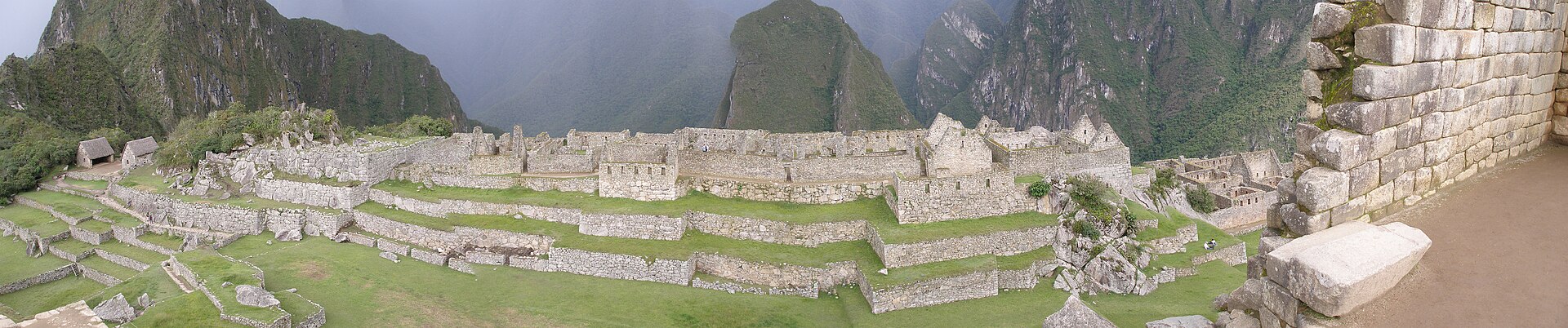
[ edit ] Machu Picchu's main sectors Agricultural sector (terraces) Urban sector (buildings) The site is divided into two main sectors: an agricultural sector to the southeast composed of terraces ( andenes ), and an urban sector to the northeast containing residences, places of worship, and warehouses. The urban sector is further split into an upper town ( Hanan ) and a lower town ( Hurin ). The Hanan contains the Sacred Plaza ( Plaza Sagrada ), a courtyard complex incorporating the Main Temple and the Temple of the Three Windows and capped by a pyramid-like stone platform on which the Intihuatana stands. In contrast, the Hurin is marked by trapezoidal doorways and small rectangular kanchas , including three large, symmetrically arranged kanchas with housing and workshops overlooking the Main Square ( Plaza Principal ), and a large single-entrance building interpreted as an Acllahuasi ; nearby is the Temple of the Condor, which includes ritual caves and a large carved stone often interpreted as a condor . The architecture is adapted to the mountains. Approximately 200 buildings are arranged on wide parallel terraces around an east–west central square. The various compounds, called kanchas , are long and narrow in order to exploit the terrain. Sophisticated channeling systems provided irrigation for the fields. Stone stairways set in the walls allowed access to the different levels across the site. The eastern section of the city was probably residential. The western section, separated by the square, was for religious and ceremonial purposes. This section contains the Torreón , the massive tower which may have been used as an observatory . Located in the urban sector are the primary archaeological treasures and tourist attractions: the Intihuatana , the Temple of the Sun, and the Temple of the Three Windows . The Popular District, or Residential District, is the place where the lower-class people live. It includes storage buildings and simple houses. The Guardian's house is a three-sided building, with one of its long sides opening onto the Terrace of the Ceremonial Rock. The three-sided style of Inca architecture is known as the wayrona style. In 2005 and 2009,
Intihuatana stone
[ edit ] The Intihuatana stone aligns with solar events and sacred mountains; its function as a solar calendar remains debated. Rock-carved "mortars" in the Room of the Mortars. Once proposed as water mirrors for astronomical use, studies from 2022 have cast doubt on any calendrical function, and their original purpose remains uncertain. Main article: Intihuatana, Urubamba Located on a terraced hill within the urban sector, the Intihuatana is a ritual stone which the Incas used. The stone is designed to point directly at the Sun during the winter solstice . The name of the stone, likely attributed by Bingham due to a similar monument in Pisac, comes from Quechua and means "place where the sun is tied". While its exact function is debated, scholars generally reject the popular idea that it served as a solar calendar gnomon . Instead, it may have been used for horizontal solar observations and was aligned with sacred mountains and cardinal directions. The stone is situated at 13°9'48" S. At midday on 11 November and 30 January, the Sun is situated almost exactly above the pillar, casting no shadow. On 21 June, the stone casts the longest shadow on its southern side, and on 21 December, a much shorter shadow on its northern side. Its placement may have held symbolic significance within a sacred landscape, aligning with prominent surrounding peaks such as Veronica , Salcantay , and Huayna Picchu.
Construction
[ edit ] Main article: Incan architecture Residential section with closely joined stones typical of Inca dry masonry The central buildings of Machu Picchu are built in classical Inca dry masonry , with large blocks precisely shaped through quarrying , stone-cutting , and stone-dressing , then fitted together without mortar . The site may have been intentionally built on fault lines to provide natural drainage and a source of fractured stone for construction. According to geologist Rualdo Menegat, Machu Picchu "shows us that the Incan civilization was an empire of fractured rocks." Inca quarry at Machu Picchu, where large irregular granite blocks from a natural granitic chaos were used as building stone. The section of the mountain where Machu Picchu was built provided various challenges that the Incas solved with local materials. One issue was the seismic activity due to two fault lines, which made mortar and similar building methods nearly useless. Instead, the Inca mined stones from some quarries at the site, including one identified in 2023 using remote sensing techniques, which was probably located in the catchment area between the Hurin and Hanan before it was covered over to create the current Plaza Principal . Once mined, the Inca lined the granite stones up and shaped them to fit together perfectly, stabilizing the structures. Inca walls have many stabilizing features: doors and windows are trapezoidal, narrowing from bottom to top; corners are usually rounded; inside corners often incline slightly into the rooms, and L-shaped blocks are often tied together outside corners; walls are offset slightly from row to row rather than rising straight from bottom to top. Heavy rainfall required terraces to drain rainwater and prevent mudslides, landslides, erosion, and flooding. Terraces were layered with stone chips, sand, dirt, and topsoil to absorb water and prevent it from running down the mountain. Similar layering protected the large city center from flooding. Multiple canals and reserves throughout the city provided water that could be supplied to the terraces for irrigation and to prevent erosion and flooding. The approach to moving and placing the enormo