STONEHENGE · OVERVIEW
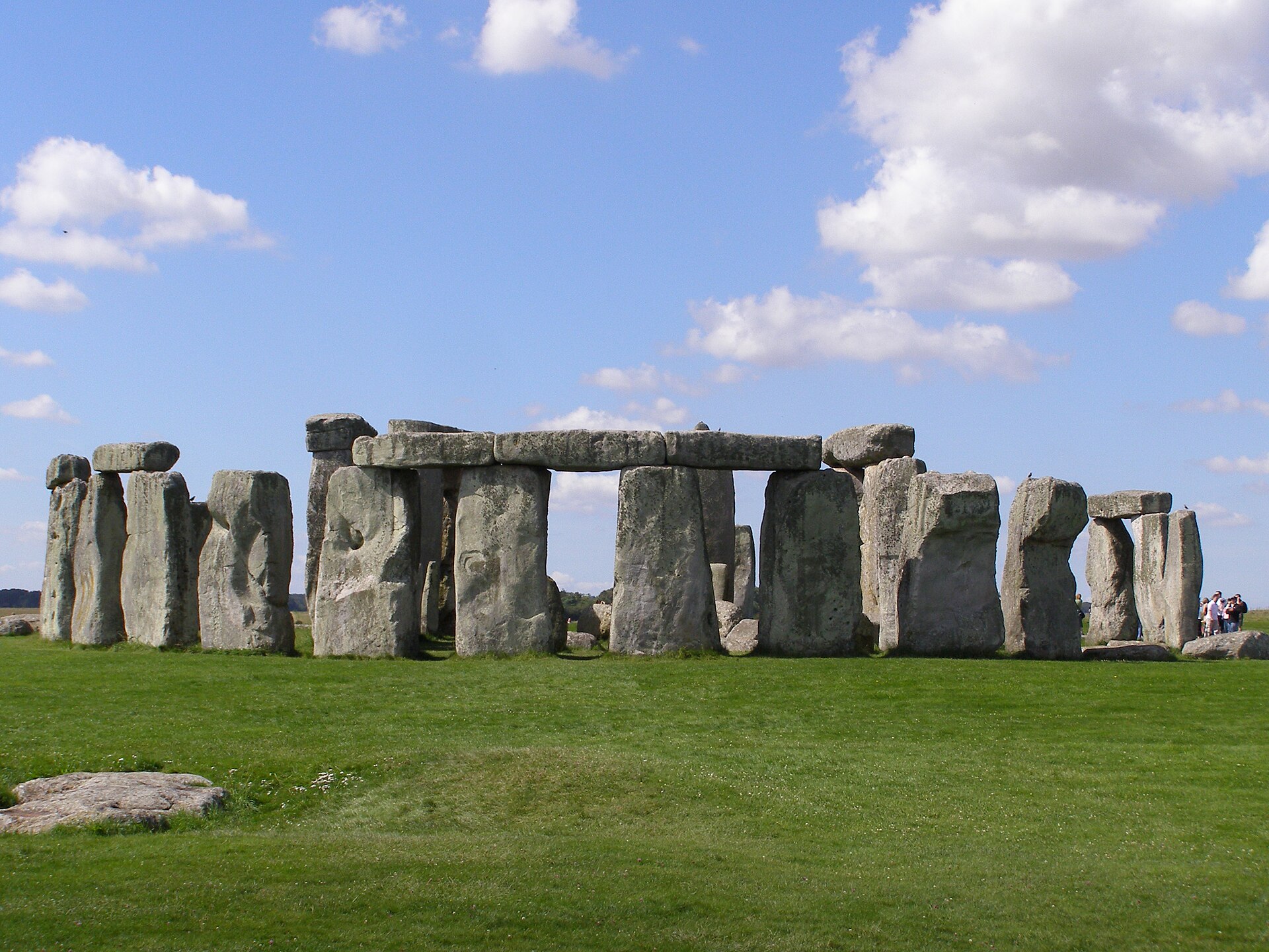
Stonehenge is a prehistoric megalithic structure on Salisbury Plain in Wiltshire, England, two miles (3 km) west of Amesbury. It consists of an outer ring of vertical sarsen standing stones, each around 13 feet (4.0 m) high, seven feet (2.1 m) wide, and weighing around 25 tons, topped by connecting horizontal lintel stones which are held in place with mortise and tenon joints—a feature unique among contemporary monuments. Inside is a ring of smaller bluestones. Inside these are free-standing trilithons: two bulkier vertical sarsens joined by a single lintel. The whole monument, now in ruins, is aligned towards the sunrise on the summer solstice and sunset on the winter solstice. The stones are set within earthworks in the middle of the densest complex of Neolithic and Bronze Age monuments in England, including several hundred tumuli.
LOCATION ·
51.17889, -1.82611
World Heritage Record
Inscribed on the UNESCO World Heritage List in 1986. World Heritage criteria: (i)(ii)(iii). Official property area: 5,152.39 ha.
SOURCE · UNESCO World Heritage Centre
Outstanding Universal Value
The World Heritage property Stonehenge, Avebury and Associated Sites is internationally important for its complexes of outstanding prehistoric monuments. Stonehenge is the most architecturally sophisticated prehistoric stone circle in the world, while Avebury is the largest. Together with inter-related monuments, and their associated landscapes, they demonstrate Neolithic and Bronze Age ceremonial and mortuary practices resulting from around 2000 years of continuous use and monument building between circa 3700 and 1600 BC.
SOURCE · UNESCO World Heritage Centre
Integrity & Condition
The boundaries of the property capture the attributes that together convey Outstanding Universal Value at Stonehenge and Avebury. They contain the major Neolithic and Bronze Age monuments that exemplify the creative genius and technological skills for which the property is inscribed. The Avebury and Stonehenge landscapes are extensive, both being around 25 square kilometres, and capture the relationship between the monuments as well as their landscape setting.
SOURCE · UNESCO World Heritage Centre
Authenticity
Interventions have been limited mainly to excavations and the re-erection of some fallen or buried stones to their known positions in the early and mid-twentieth century in order to improve understanding. Ploughing, burrowing animals and early excavation have resulted in some losses but what remains is remarkable in its completeness and concentration.
SOURCE · UNESCO World Heritage Centre
Protection & Management
The UK Government protects World Heritage properties in England in two ways: firstly, individual buildings, monuments and landscapes are designated under the Planning (Listed Buildings and Conservation Areas) Act 1990 and the 1979 Ancient Monuments and Archaeological Areas Act, and secondly through the UK Spatial Planning system under the provisions of the Town and Country Planning Acts. The individual sites within the property are protected through the Government’s designation of individual buildings, monuments, gardens and landscapes. Government guidance on protecting the Historic Environment and World Heritage is set out in National Planning Policy Framework and Circular 07/09.
SOURCE · UNESCO World Heritage Centre
Origin of sarsens, bluestones and other modern developments
[ edit ] Map of Stonehenge monument and detailed plan of individual numbered sarsen stones, bluestones and Altar Stone In July 2020, a study led by David Nash of the University of Brighton concluded that the large sarsen stones were "a direct chemical match" to those found at West Woods near Marlborough, Wiltshire , some 15 miles (25 km) north of Stonehenge. A core sample, originally extracted in 1958, had recently been returned. First, the fifty-two sarsens were analysed using methods including x-ray fluorescence spectrometry to determine their chemical composition, which revealed they were mostly similar. The core was then destructively analysed and compared with stone samples from various locations in southern Britain. Fifty of the fifty-two megaliths were found to match sarsens in West Woods, thereby identifying the probable origin of the stones. During 2017 and 2018, excavations by professor Parker Pearson's team at Waun Mawn , a large stone circle site in the Preseli Hills , suggested that the site had originally housed a 110-metre (360 ft) diameter stone circle of the same size as Stonehenge's original bluestone circle, also orientated towards the midsummer solstice. The circle at Waun Mawn also contained a hole from one stone which had a distinctive pentagonal shape, very closely matching the one pentagonal stone at Stonehenge (stonehole 91 at Waun Mawn and stone 62 at Stonehenge). Soil dating of the sediments within the revealed stone holes, via optically stimulated luminescence (OSL), suggested the absent stones at Waun Mawn had been erected around 3400–3200 BC, and removed around 300–400 years later, a date consistent with theories that the same stones were moved and used at Stonehenge, before later being reorganised into their present locations and supplemented with local sarsens as was already understood. Human activity at Waun Mawn ceased around the same time which has suggested that some people may have migrated to Stonehenge. It has also been suggested that stones from other sources may have been added to Stonehenge, perhaps from other dismantled circles in the region. Further work in 2021 by Parker Pearson's team concluded that the Waun Mawn cir